

SIGNIEL BUSAN Map
You can check the route of the Haeundae Beach promenade, the location of the electric vehicle charging station, and the jogging course.
Haeundae Beach Trail
This is a map of the movement of Haeundae Beach promenade.
LCT The Mall is currently in store, so please refer to the operating hours for flexible use.
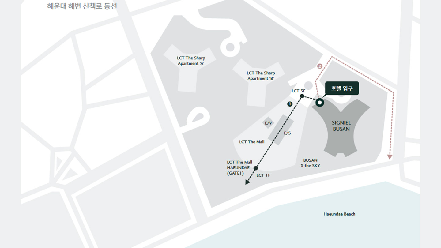
■ Customers moving to Haeundae Beach from inside the hotel
Hotel Main Gate → LCT The Mall → Ride the elevator or escalator → 1st floor → Haeundae Beach
■ Customers moving to Haeundae Beach from outside the hotel
Right at the main gate of the hotel → Right at the three-way intersection → toward Mipo Port
EV Charging Station
To find the route to the EV charging station refer to the below map.
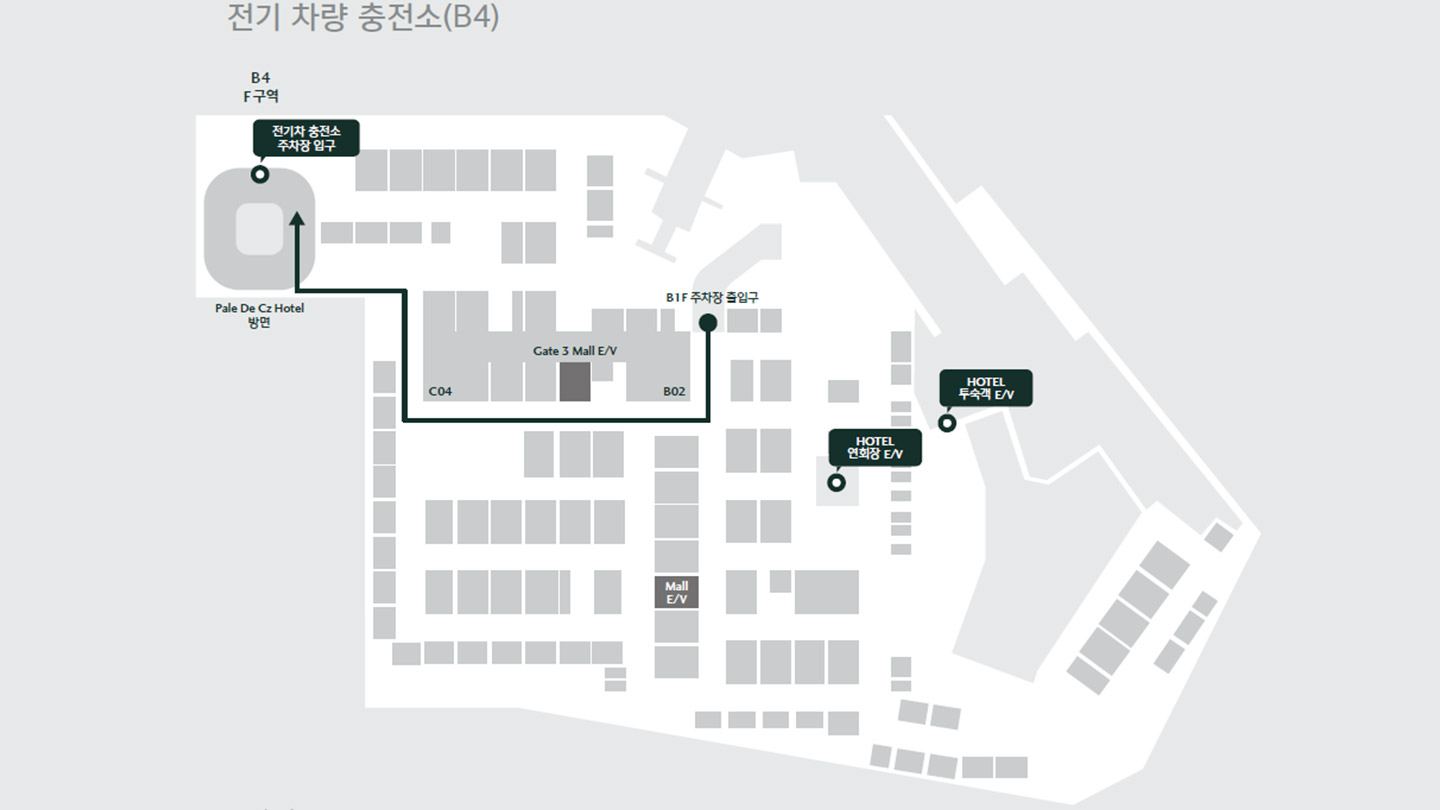
■ Route to the EV charging station (hotel parking lot → electric vehicle charging station route)
Entrance to parking lot → Exit area to 'Palette Seas' on B1F → Area F on B4F
■ Route back to hotel from the EV charging station
B4F LCT The Mall GATE No. 3 Elevator → Get off on the 3rd floor → LCT MALL entrance → Hotel entrance
Haeundae Jogging Course
This is an information map of the Haeundae jogging course.
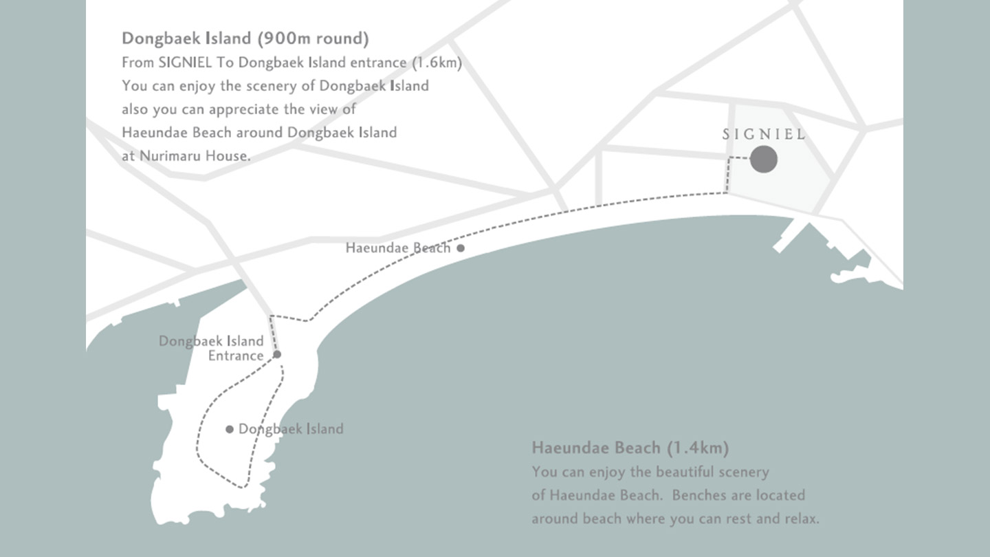
■ Dongbaek Island (about 900 meters)
Distance from Signiel Busan to Dongbaek Island (1.6 kilometers)
You can enjoy the scenery of Dongbaek Island, and at Nurimaru House, you can enjoy the scenery of Haeundae around Dongbaek Island
■ Haeundae Beach (1.4 km)
You can enjoy the beautiful scenery of Haeundae, and there are benches around the beach for relaxation.